


Farm records that work offline.
Web and mobile workflows for Industree Foundation's bamboo programme, with a shared record of farms, land parcels and plantations.
Client: Industree Foundation
The context.
Industree Foundation needed a reliable record of farms, land parcels and plantations across remote districts. Field teams had to collect usable data with intermittent connectivity. Programme administrators needed one view across regions.
No shared farm record.
There was no reliable record of farms, land areas or what grows best where. Data collection happened on paper in districts with patchy connectivity, and guidance had to reach farmers in their own languages.
- Capturing data in districts with little or no connectivity
- Accurate geotagging and land-area calculation in the field
- Species recommendations from soil, climate and rainfall data
- Training in regional languages
Offline field records and a programme view.
Field teams use the Android app for baseline records, land verification, soil sampling and plantation monitoring. Each record is geotagged, stored on the phone and synchronised to a central repository when the network returns. Administrators see the combined picture on the web dashboard.
The system in three steps.
A visit is saved locally, with or without a connection.
The record belongs to a geotagged land parcel.
Records reach the programme view when connectivity returns.
Inside the workflow.
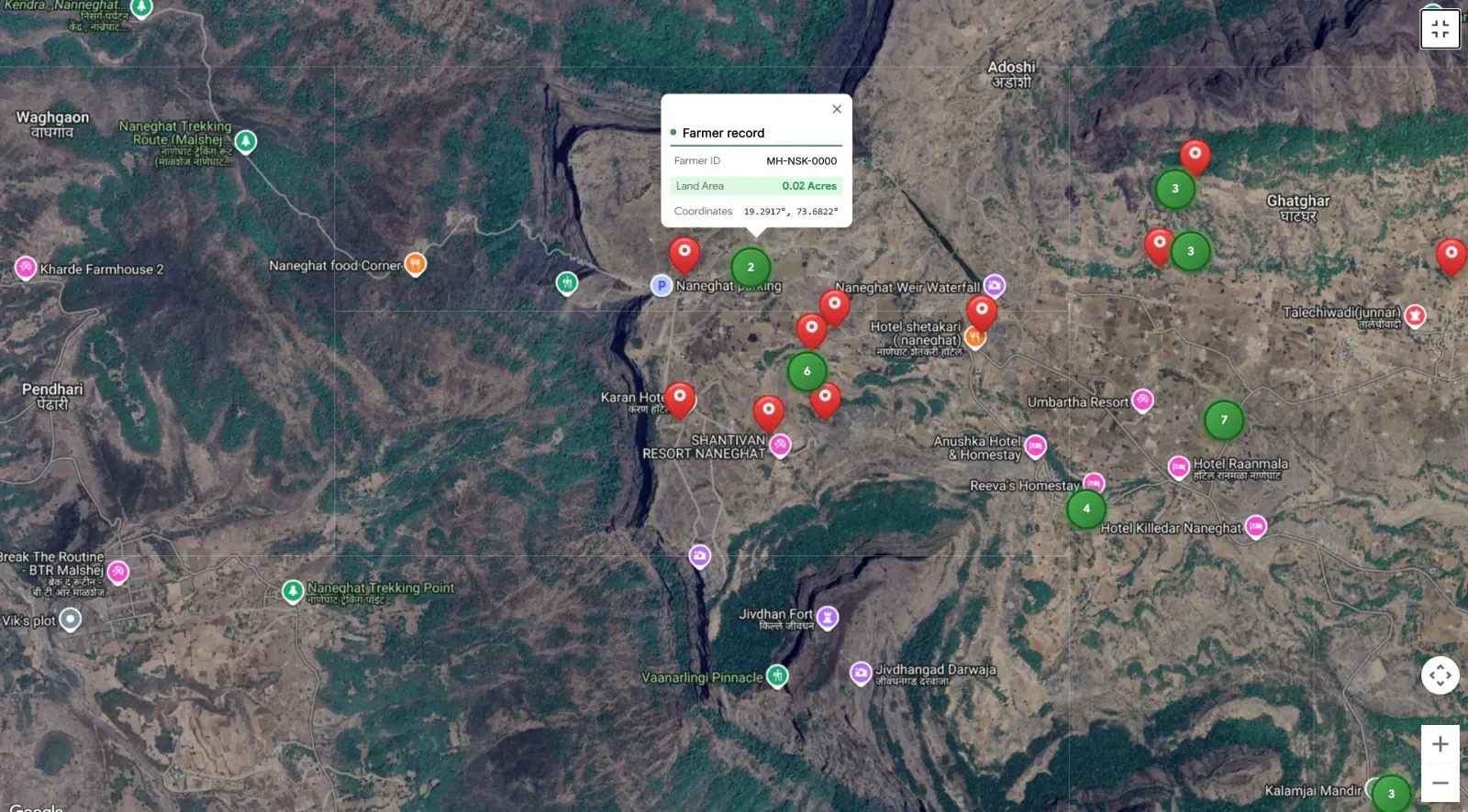
Map the farm record
Field teams geotag plantations and record the land area. The farm record links to a measured parcel on the map.
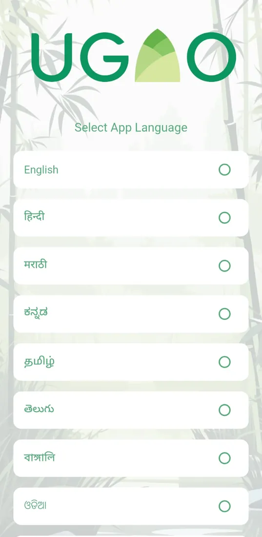
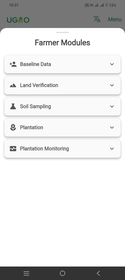
Field capture in regional languages
The field app covers baseline records, land verification, soil sampling and plantation monitoring, in eight languages.
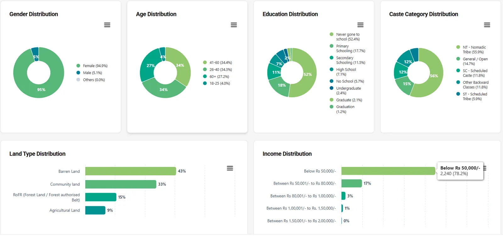
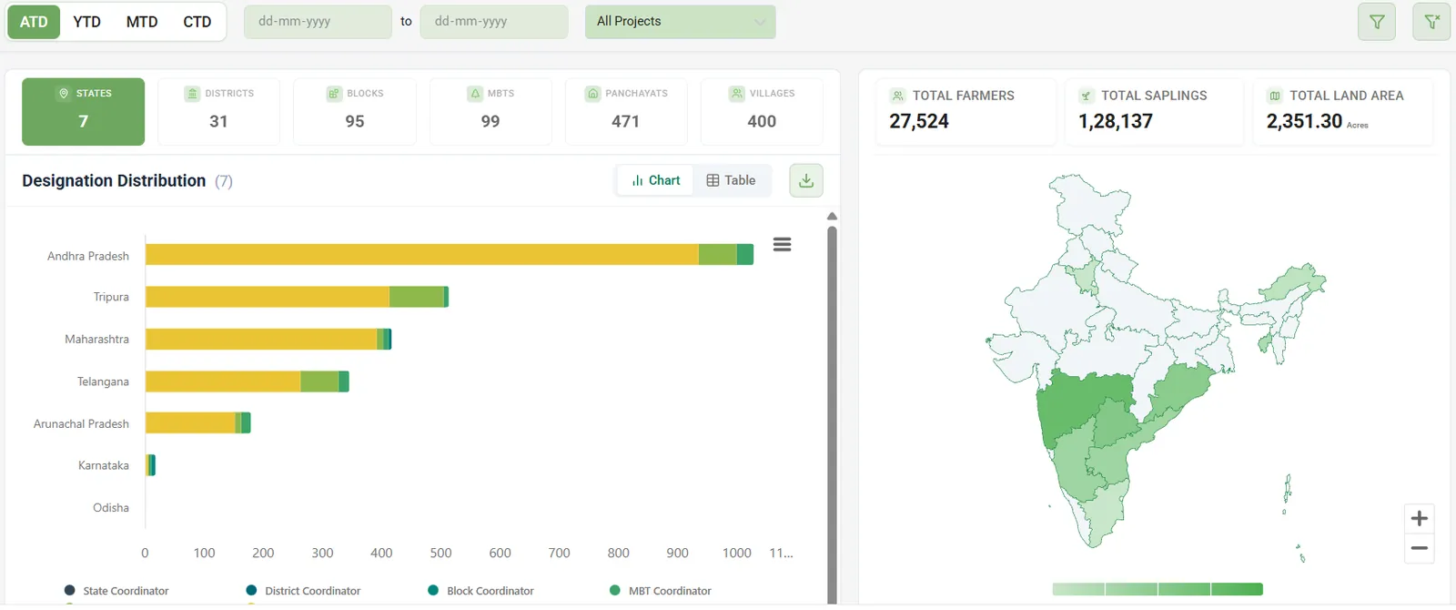
View programme participation
The dashboard groups participants by demographic and land categories, so administrators can see who the programme reaches.
What the platform does.
-
Geotagging
Farms are mapped and their land area is calculated in the field.
-
Offline capture
Records are kept on the phone and synchronised once the network returns.
-
Species advisory
Cultivation recommendations draw on soil, climate and rainfall data.
-
Regional languages
The field app runs in eight languages, so training reaches farmers in their own.
What changed.
100,000 farmers were onboarded across six states, and the programme plans for 500,000 by 2027. Figures are from the engagement write-up.
- farmers onboarded
- 100,000
- states
- 6
Decisions behind the work.
Capture works offline first, because many programme districts have patchy connectivity.
Each farm record is tied to a geotagged parcel with a calculated land area.
Species recommendations draw on soil, climate and rainfall data.
Industree has a lot of complex use cases and technical requirements around the bamboo value chain. We have partnered with Wysbryx team to help build a custom tech platform since our needs can't be fully met by commercial tools. They have helped us achieve that without any delays, cost overshoot or quality issues. This tech stack will be the backbone of our operations, and eventually help us scale.